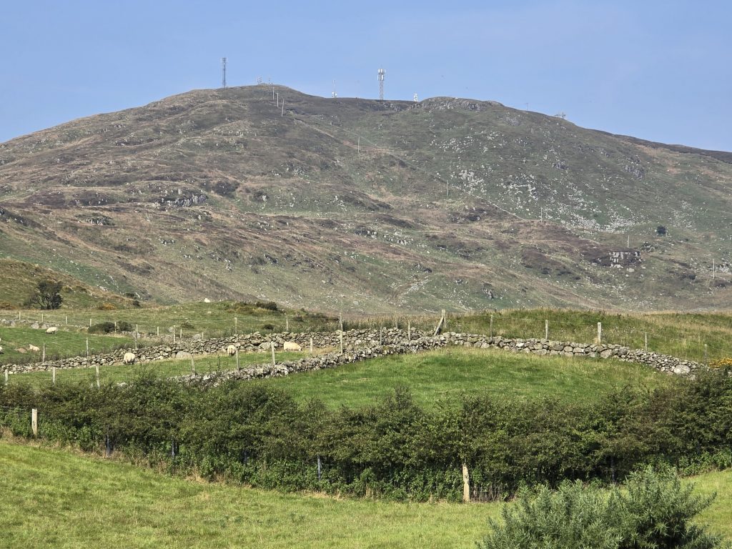
Slieve Croob is a hill site north of the Mourne Mountains, near Dromara, Co. Down. Standing 1750ft above sea level, it offers varied ridge soaring opportunities, though these are limited by wind direction. The site has a tarmac road leading up to the transmitter at the summit.
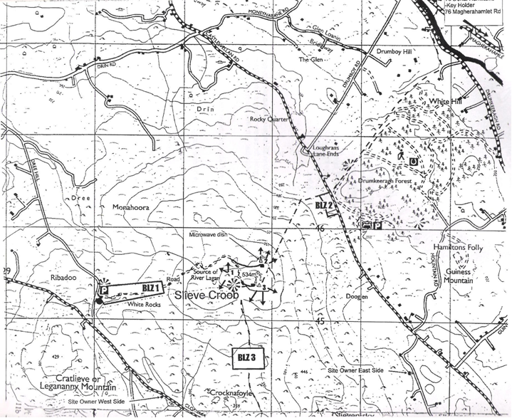
Location: Irish Grid Reference J319454
Wind Directions: North-northeast, northeast, east, southwest, west, northwest (best in N/NE winds).
- Important Note: In practice, the only reliable soaring directions are North-east through East. There is a very small soarable South-west slope, but soaring in any other direction is very limited, if at all possible. Other directions should be treated as top-to-bottom only.
Suitable for: Primarily paragliding; hang gliding is limited to some wind directions
Pilot Rating: BHPA Club Pilot
Airspace: Class D above 3500ft ALT. UHPC members can extend the ceiling to 5000ft by activating ‘Croob – Designated Area 2’. See the Air Traffic Control section below.
Access Information
- Road Access: From Dromara, take the road to Finnis, then left at Finnis up Dree Hill Road to the car park.
- Parking: Park at the car park, or in lay-bys along the route, depending on wind direction.
Site Access
- Path to Summit: Walk along the access road, a 500ft climb that takes about 20 minutes.
- Landowner Sensitivity: Be aware that landowner issues have arisen here. If requested by a landowner, please leave the area immediately.
Site Rules and Hazards
- Parking: Do not obstruct the private road, and use the minimum number of vehicles necessary.
- Pilot Guidance: Pilots unfamiliar with Slieve Croob should consult an experienced club pilot or instructor (Donal Hamilton has extensive experience here).
- Hazards:
- Transmitter and power cables on the southeast face
- Microwave radiation near the summit
- The summit drops steeply on all sides
- Rotor Hazard: Avoid being blown back onto the lee side, as rotor turbulence can be severe.
- Microlight Activity: Be aware of microlights from the nearby Slieve Croob Flying Club.
Launch and Landing Zones
- Launch:
- West, Northwest, Southwest: Shallow grassy slopes, generally manageable; however, upwind slopes may cause turbulence in strong winds.
- East, North-Northeast: Descend below the microwave dish to find a suitable launch point. The ground in this area is rough.
- Southwest to Southeast: Limited ridges for soaring; conditions here favor paragliding, and it can be very thermic.
- Bottom Landing Zone:
- Ideal for paragliders; hang glider pilots should inspect for sloping ground before flying.
- North-Northeast Wind: The landing zone is large and up-sloping. Approach with extra speed to counter wind gradient.
- Easterly Wind: Avoid bottom landings here as the field is small and down-sloping, and turbulence from the nearby forest is likely.
- Top Landing Zone:
- Paragliders: Generally easy landing.
- Hang gliders: Land near the road below the transmitter. Check conditions before launch, and approach with additional speed to account for turbulence.
Air Traffic Control Restrictions
- Class D Airspace: Class D airspace begins at 3500ft amsl. The site lies within ‘Croob – Designated Area 2’ as specified in the Letter of Agreement (LOA) with Aldergrove ATC. UHPC members can activate this area to extend the ceiling from 3500ft to 5000ft by following LOA procedures. Refer to the Designated Areas Map for boundaries.
This guide provides essential information for safe flying at Slieve Croob. Be mindful of local hazards, coordinate with ATC as needed, and follow site-specific protocols to ensure a safe experience.