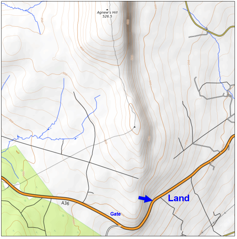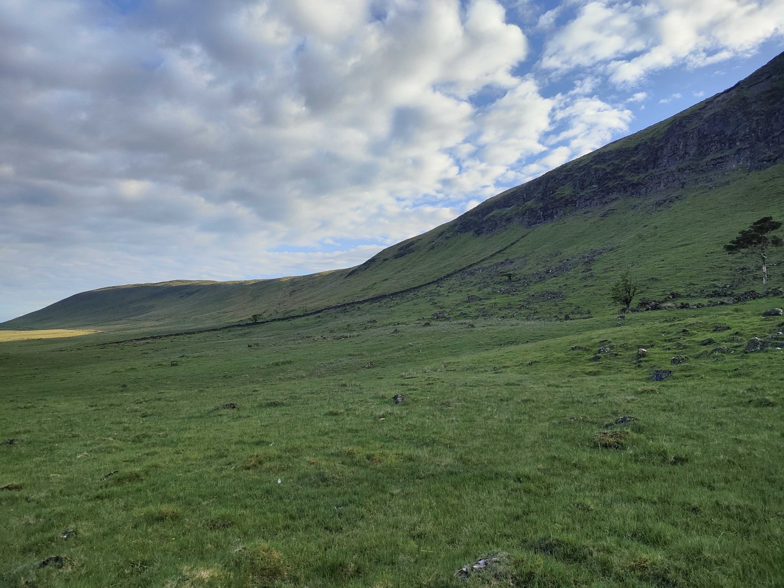
Shane’s Hill is a small south-easterly facing hill at the southern end of Agnew’s ridge, forming part of a 2-mile-long ridge. The launch sits at 1100ft above sea level, with the terrain rising to 1550ft at Agnew’s cliff. Under optimal conditions, it’s possible to fly to and return from Agnew’s launch.
Location: Irish Grid Reference J333987
Wind Directions: East-southeast, 090 – 145 degrees (ideal at 110)
Suitable for: Hang gliding and paragliding
Pilot Rating: BHPA Club Pilots; also suitable for students
Airspace: Class D above 2000ft ALT. UHPC members can extend the ceiling to 5000ft by activating ‘Big Collin/Agnew’s – Designated Area 1’. See the Air Traffic Control section below.
Access Information
- Road Access: Access via the main Larne/Ballymena Road’s highest point (see map) or from a tarmac layby at the hill’s base.
- Parking: Park on the hard shoulder north of the road near the locked gate or in the bottom layby. Do not obstruct or climb gates or fences. UHPC members with at least a BHPA Club Pilot Novice rating can obtain a key to the gate padlock from the Sites Officer at cost.
Site Access
- Top Parking Area: Unlock the gate, pass through, relock the gate, and follow the path to the right, through another gate. Walk along the stone wall to the left for about 100 yards, then proceed to the highest point on the hill.
- Bottom Layby Parking Area: Walk through the gate and up the hill to the takeoff area. This gate is typically unlocked.
- Alternative Access: There is a rough but driveable lane behind the hill that leads to the dip between Shane’s and Agnew’s Hill. This access follows the same route as Agnew’s W & SW access.
Site Rules and Hazards
- Main Road: The road curves around the base of the hill, so avoid flying close to it when low to prevent startling drivers on the bend.
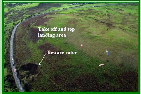
- Quarry: A small, disused quarry below and to the left of the launch may cause turbulence.
- Power Lines and Obstacles: The bottom landing area has power lines and other obstructions.
Launch and Landing Areas
- Launch: The launch area is smooth and rounded, generally presenting no issues.
- Bottom Landing: Bottom landings are challenging, especially for hang gliders, due to the slope and cables. Paragliders can land more easily on either side of the road near the layby. Hang gliders should consider uphill downwind landings in light winds.
- Top Landing: The primary top landing area is behind the launch at the hill’s rear, providing a good upslope for easy landings, especially for hang gliders. Avoid landing close to the fence.
Air Traffic Control Restrictions
- Class D Airspace: Class D airspace begins at 2000ft ALT. The site lies within ‘Big Collin/Agnew’s – Designated Area 1,’ as defined in the Letter of Agreement (LOA) with Aldergrove ATC. UHPC members can activate this area, raising the ceiling from 2000ft to 5000ft by following the LOA procedure. See the Designated Areas Map for details.